Geo5 Geoconsulting Services and Seismic Data Solutions

Geo5 provide geoconsulting services, scientific studies and data processing software for business and science clients carrying out subsurface exploration. The company originated from a Joanneum Research group in 2015.
Seismic interpretation for geoscience projects
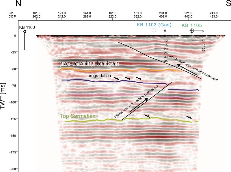
The aim of seismic reflection studies is the visualisation of the subsurface (faults, horizons, fractures, karst features and channels) and the generation of 3D structural models. Typically, the first step of an interpretation work is the correlation between seismic data and borehole information. This seismic-to-well-tie aims to identify geologically meaningful marker horizons and determine their seismic phase.
The interpretation of reflection data can be based on various approaches. One method is a conventional interpretation of seismic amplitude sections. Seismic reflectors are tracked laterally to generate a structural and stratigraphic map of the subsurface conditions.
Another method uses a sequence stratigraphic approach to interpret the data. The seismic sequence stratigraphic method is used to establish the genetic relationship of the interpreted lithology. Observed reflection patterns are compared to models of recurrent periods of deposition. Phases of deposition and erosion separated by unconformities can, therefore, be reconstructed.
A third method is the usage of volumetric seismic attributes, which are quantities usually extracted or derived from seismic amplitude cubes.
These derived attributes enhance the information from the input cube and lead to a better visualisation and quantisation of geological structures, lithologies and reservoir parameters. Most seismic attributes are calculated from post-stack data, but for some attributes such as amplitude versus offset (AVO) and inversion, it is necessary to use pre-stack seismic data. Seismic attribute calculation can be done on single traces or across multiple traces within a predefined analysis window. Seismic data can be in time or depth domain. Regarding the domain data, the final step in an interpretation project is time-depth conversion. For this purpose, a velocity model based on well log information is established.
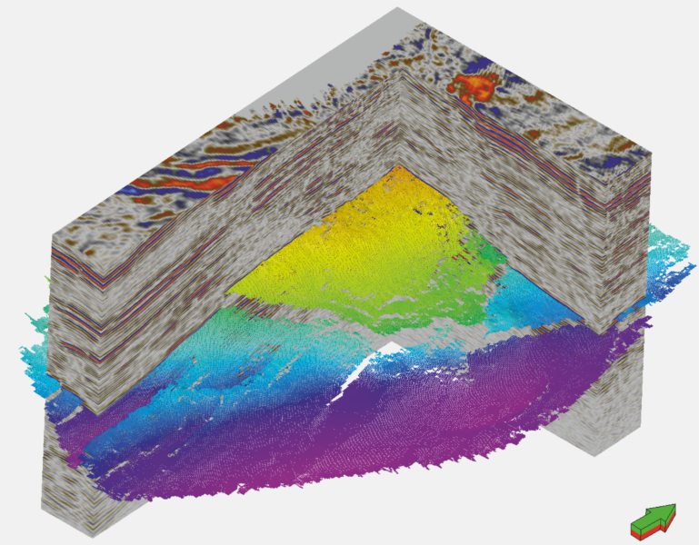
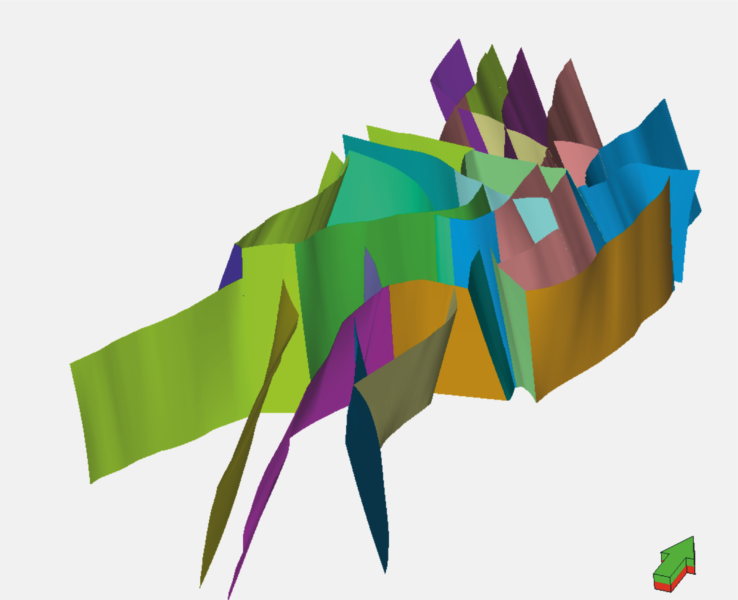
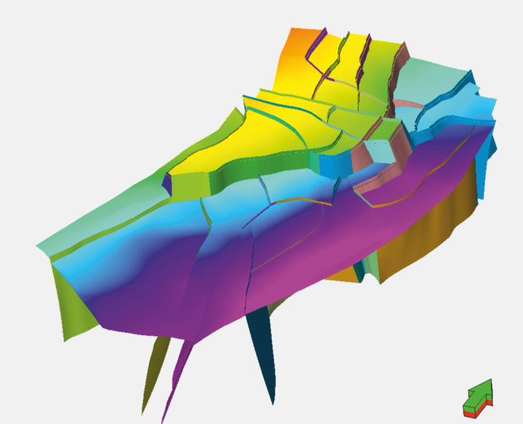
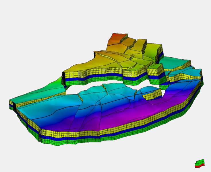
3D Geological Modelling
The aim of structural modelling is to establish a simplified image of the subsurface. The structural model is the basis for all other modelling processes (property, facies and fracture). Property modelling is the spatial distribution of reservoir parameters such as porosity, permeability, water saturation or volume of shale. The inputs for the property model are petrophysical interpretations and also seismic attributes that act as trends. The petrophysical interpretations are upscaled into the structural model. In the upscaling process, each cell that is penetrated by a well gets one single value for every property. Afterwards, data analysis is performed to derive geostatistical parameters for each property.
These geostatistical parameters are then used to spatially distribute the upscaled values. With the help of seismic attributes, it is possible to improve the spatial distribution as they can act as trend properties. Facies models are discrete distributions of facies derived from well logs. Similar to petrophysical modelling, the distribution can be guided by seismic attributes. A fracture model is a representation of planes that can be used to determine fracture parameters such as porosity and permeability.
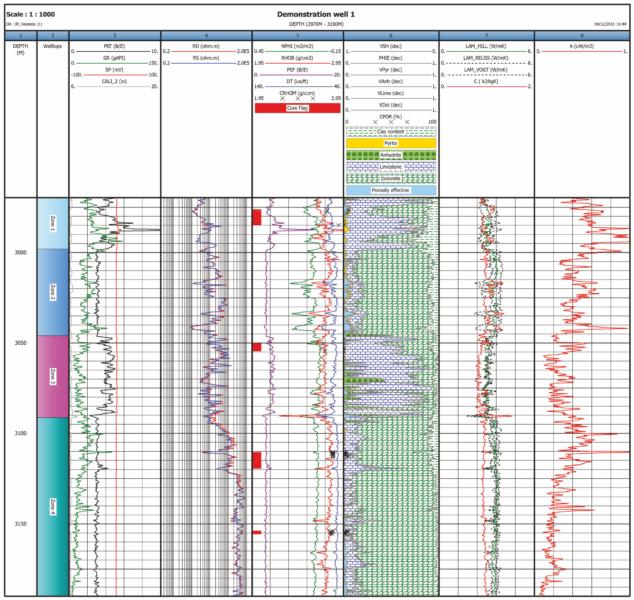
Well log interpretation for geological reservoir studies
Before well logs can be interpreted, it is necessary to carry out quality control, condition data, and environmentally correct the logging information. In case that logs are available in analogue form only, well log digitisation is an important step to implement all logs in a reservoir study. Afterwards, log splicing of logging runs and depth shifting have to be carried out.
Log correlation is used to compare geological facies of the same age and formation laterally. Reservoir parameters can be determined by a petrophysical log analysis. For this purpose, well log information and core data are integrated to derive reservoir parameters such as porosity, permeability, the volume of shale and thermal conductivity.
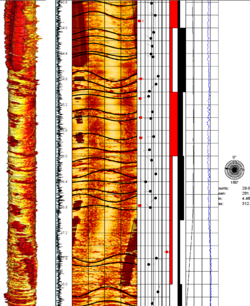
Depending on the type of lithology, the workflow should be adapted. Image logs such as FMI or UBI are 2D representations of the borehole wall. With the help of image logs, it is possible to interpret fractures and faults to determine regional stress directions and to identify thin beds.
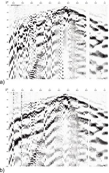
Seismic reflection processing
Processing is the systematic structured preparation of seismic field data for the interpretation to follow. The aim of seismic processing is the increase of signal to noise ratio and the sharpness of signal (higher frequencies). In this process, care needs to be taken to preserve as much information as possible about the subsurface structure.
In seismic processing, subsurface velocities are estimated to generate a stacked seismic model. These stacking velocities can also be used in the interpretation process for establishing a time-depth relationship. The result of this processing is a final stacked migrated section.
Software development for seismic attribute calculation
In addition to providing geological services, Geo5 is engaged in the development of software, such as plug-ins for processing and interpretation of geophysical data, which ensures efficient and valid data interpretation.
Geo5 Images
Products and Services
Video
White Papers
Geophysical Services: Research & Development
Geo5 provide geoconsulting services, scientific studies and data processing software for business and science clients carrying out subsurface exploration.
Seismic Reflection for Geothermics
Seismic reflection is based on the propagation of elastic waves. Elastic waves are stimulated artificially by an energy source. The energy source can be dynamite, sledge hammer, mechanic drop weight, or vibrators.
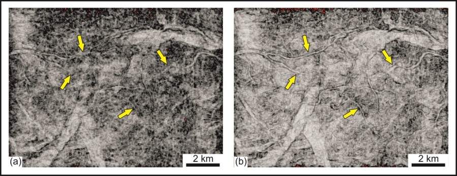
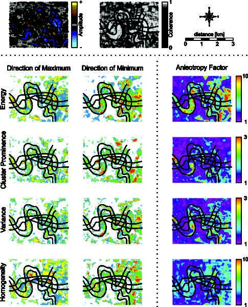
FracTex: Visualise Your Fractures
FracTex plugin computes GLCM-based attributes in different directions and compares these results. Based on that comparison a factor for seismic anisotropy is computed and the azimuth of the direction with most variability in seismic character is determined.